|
Description of the Basic Scenery
Addon to Misty Fjords Scenery
Scenery by Bill Dick, AI Traffic by Phil Cayton
(Note we are being "Dial
up Sensitive" by splitting these first three files)
| Type AI |
Name |
ICAO Code |
Runway |
| Seaplane AI |
Totem Bight Seaplane
|
MMI1
|
8/26 Water |
| Airfield AI |
Totem Bight Airfield
|
MMI2
|
9/27 Asphalt |
| Seaplane AI |
Herring Bay Seaplane
|
MMI3
|
2/20 Water |
| Seaplane AI |
Hunter Bay Cannery Seaplane
|
MMI4
|
6/24 Water |
| Seaplane AI |
Smith Lake Hatchery Seaplane
|
MMI5
|
3/21 Water |
| Seaplane AI |
Klinkwan Fish Camp Seaplane
|
MMI6
|
13/31 Water |
| Airfield AI |
Klinkwan Fish Camp Airfield |
MMI7 |
11/29 Dirt |
| Seaplane AI |
Gwent Bay Seaplane |
MMI8 |
16/34 Water |
| Seaplane AI |
Fleet Bay Parts Dock Seaplane |
MMI9 |
2/20 Water |
|
Totem
Bight Operations Center
Misty Moorings, Inc.
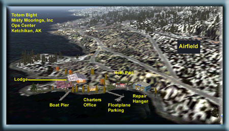
Totem Bight Ops Center - Misty
Moorings, Inc.
Totem Bight - Misty Moorings,
Inc. Our "Operations Center": Our operations
center is Totem Bight. Here we have a lodge where you can
stay. We have a nice Library
in this facility where you can learn more about Alaska in
general and Ketchikan in particular. Many of these will be
links to reference sources for the area. Our Charter
Office is also on these grounds, this is where you will
find the flight-seeing charters, and the TripTix
(special VFR irections to addon scenery locations). We also
have a Hanger where we can
work on planes and full AI traffic at both the floatplane
base out front and the airfield up behind the facility.
We have even included an Environmental
Office where we make sure the environments of the addons
are exciting with FSE and a Tool
Shed to house the various tools we use at Misty Moorings,
Inc. including our FAQ
database that helps with tips, tricks and installation
instructions. We are located right beside the Totem Bight
State Park a 5 minute flight from PAKT on the Tongass Narrows.
All VA and private aircraft are welcome at our facility which
is a convenient location to fly to anywhere in Misty Fjords.
Totem Bight State Park is on Revillagegedo Island
(pronounced reh-VEE-yah-guh-HAY-doe, or Revilla as the locals
call it), the largest island in Alaska. The path you walk
around to view the historically reproduced totem poles is
surrounded by fireweed and mountain daisies that grow abundantly
in large bouquets everywhere. During fish-spawn season it's
not uncommon to see a black bear in early morning or late-day
hours. At the south end of the park is a Tribal House. You
can go inside and see how the Natives used to live. It's a
big square or rectangle with one big sunken room inside, and
a fire pit in the center. The Natives used to live together
in these houses, and a ceremonial 'stage' is at one end. Plenty
of room for all, and if you come on the right day, you may
see a Native ceremonial dance. The Tribal House is decorated
with black, red and cedar, and has carved images all around
the outside.
Since the park is right on the shoreline, you can sometimes
see whales just offshore, and more common are cormorants,
blue heron, bald eagles, sea lions, porpoise, ravens and gulls.
The forest surrounding the park is full of blue berry and
huckleberry bushes, and of course the usual salmon berries
everywhere. There are red and yellow cedar trees guarding
the centenarian poles, making the entire experience a pleasantly
educational outing! You have a view of the aircraft traffic
landing at PAKT and a good view of the cruise ships that go
right past the front lawn. Sitting on the front porch at Totem
Bight Lodge is both relaxing and entertaining at the same
time. You can see why we chose Totem Bight as our base of
operations.
|
|
|
|
Hunter Bay Cannery

The Hunter Bay Cannery is located on Hunter
Bay on the southwest side of the Prince of Wales Island,
about 40 miles direct from Ketchikan. This facility processes
the fish from the many fishing fleet boats operating out
of their base many of the fleet boats that operate out of
the Fleets Bay Parts Dock, located on the southeastern tip
of the Prince of Wales Island near Cape Chacon lighthouse.
There is a parts shop and restaurant, mostly for the fishermen
and pilots. Overnight lodging is available. There is plenty
of room to moor your boat or your floatplane along the front
docks of the cannery. The draft depth of the channels is
35 feet.
A charter is available from Ketchikan to Hunter
Bay, set for treetop VFR in case of "misty" weather.
You can get directions on the charter from the office [here].
The TripTic is [here]
|
|
|
|
Herring Bay Cannery
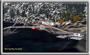
The Herring Bay Cannery Complex is located
in Herring Bay on the south west corner of Revillagegedo
Island (the largest island in Alaska, Ketchikan is on its
western side). The cannery is only a 15 minute flight from
the Totem Bight Operations Center.
No charter is available because of the brevity
of the flight. You fly south down the Tongass Narrows and
at Mountain Point, round the point to port. Herring Bay
is only 5 miles from Mountain Point. There is fuel available
here and a parts shop and coffee shop.
|
|
|
|
Gwent Bay Cannery
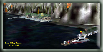
The Gwent Bay Cannery is located in Gwent
Bay situated on the northeast point of Pearse Island about
10 miles up the Portland Inlet about 59 miles east southeast
of Ketchikan. This is an old cannery complex, circa 1934,
that is not actually a functioning cannery but one that
has been restored for historical reasons. There is a shop
that dispenses bait and beer upon request. You can also
refuel your boat or your floatplane at the boat dock There
is limited lodging available for people getting caught in
sudden dangerous weather. There are also supplies here for
the many U.S. Forestry Cabins that are out in this area
of the Misty Fjords National Monument.
|
|
|
|
Klinkwan Fish Camp
and Base
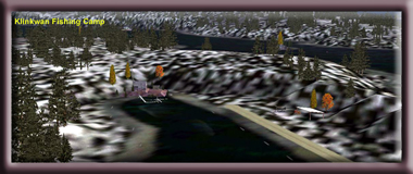
The Klinkwan Fish Camp, floatplane base and
airfield is located 2 miles west of the Hunter Bay Cannery
Complex. The lodge can house 6 people comfortably with 3
small bedrooms, a fully supplied kitchen and sitting area.
This lodge is equipped for busy fishing expeditions in this
fishing-rich area of Misty Fjords. There is a picnic table
and a small smokehouse for smoking fish. There is a nice
dock for your boat, and the fishing off the dock is also
excellent especially in the evening.
To get to the Klinkwan Fish Camp, use the
Hunter Bay Cannery Charter that can be retrieved from the
Totem Bight Ops Office, or you can click [here].
This charter comes with a briefing, with FSNav maps and
complete treetop VFR instructions. When you get to the landing
zone for the cannery, you turn to 270 for 2 miles and you
will find the fishing camp, the airfield and the floatplane
base. TripTic available [here].
|
|
|
|
Smith Lake Hatchery
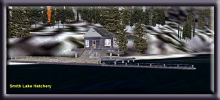
The Smith Lake Hatchery is located on Hugh
Smith Lake, not too far from the US Forestry Service Cabin
located there. The hatchery is active year around although
less visited, obviously, in the winter. There are fine hiking
trails that link the Hugh Smith Lake Cabin to the hatchery.
There is also an abandoned cannery in the area that you
can explore during those summertime hiking trips.
To get to the hatchery, follow the directions
in the Hugh Smith Lake Cabin charter. Fly to the touchdown
fix out in the water in front of the cabin and fly almost
straight ahead for another mile to land in front of the
hatchery. You can get the charter for the Hugh Smith Cabin
[here]. TripTic [here]
|
|
|
|
Fleet Bay Parts Dock
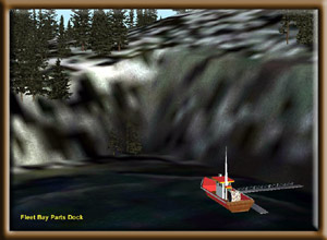
The Fleet Bay Parts Dock is a supply point
for the fishing fleet that is based in Fleet Bay. This facility
is to the west of the most southeast point of the Prince
of Wales Island. You fly to the Cape Chacon lighthouse and
to the west around the point about 4 miles. There are charters
that go to this area because parts are so important for
the fleet that operates from here.
Until a new charter is ready, fly to Hunter
Bay but at Kendrick Island, fly about 30 degrees down the
eastern side of the island until you get to Chacon Point.
When you see the lighthouse, go on around that point and
you will find Fleet Bay. The Hunter Bay charter is [here].
|
|
|

(Counter Activated January 18th, 2005)
|
|
|
|
|
