 |
|
Route Notes:
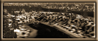
Klinkwan Fish Camp The Klinkwan Fish Camp, floatplane base and airfield is located 2 miles west of the Hunter Bay Cannery Complex. The lodge can house 6 people comfortably with 3 small bedrooms, a fully supplied kitchen and sitting area. This lodge is equipped for busy fishing expeditions in this fishing-rich area of Misty Fjords. There is a picnic table and a small smokehouse for smoking fish. There is a nice dock for your boat, and the fishing off the dock is also excellent especially in the evening. TreeTop VFR Plan From: Ketchikan International VFR Directions: Flying to the Hunter Bay Cannery 1. After leaving PAKT or 5KE, position over the center Pennock Island in the Tongass Narrows at a heading of 110 2. At the midpoint of
Pennock Island, set a heading of 141 to Gravina Point. This is the
point of land at the southern most tip of Gravina Island (the large
island on your right), about 2.9 miles distant. 3. At Gravina Point, set a heading of 194 for 3 miles to fly over Blank Island. 4. Over Blank Island, set a heading of 196 heading
for Bostwick Point ... the point just ahead. 5. Over Bostwick Point, we set a course of 170
for the Bron Island, fly to its center. 6. Exactly over the center of Bron Island,
set a course of 185. This course will take you to the mouth of Kendrick
Bay, 18.5 miles ahead. 7. Over Kendrick Island, set a heading of 242.
8. Over Hunter Bay, fly low toward the end of
the bay. =============================================================== VFR Directions: Returning to Ketchikan Direct Heading is: 009 for 35 miles Taxi out and take off lining up with a heading
of 063. Hessa Lake will come up on the port side of the aircraft.
Continue for 6.5 miles until you are over Kendrick Island. Over Kendrick Island, set a heading for 005. Maintain
this course for 18.5 miles to Bron Island. As you pass by Dall Head and cross over Bron Island, set a heading for 355 and fly along the south coast of Gravina Island. On the way passing Seal Cove, Bostwick Point and heading for Gravina Point. If the weather is clear, you may cut across land to the left of Judy Hill and shortcut to the Tongass Channel. Watch for air traffic for PAKT in this area. Doug Linn |
|
If you have any questions or comments, you can contact us at contact@mistymoorings.com |
|
©2005 mistymoorings.com |