|
Route Notes:
- Minimum altitude: 4500 feet at Ranger Lookout Station, 1000
feet is a safe altitude for most of the trip.
- Direct Routing: If the weather is favorable, you may fly a heading
from Higgins Point of 257 for 36 miles.
- Landing zone: hard runway, (no water)
- Ranger Lookout Station Scenery needed
- Click [here] for printer-friendly
TripTic
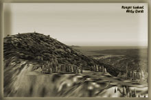
Ranger Lookout Station
Manned by the US Forestry Service as a lookout tower for forest
fires. This is a short runway on a narrow flat mountain top at about
3500 feet. You can fly low altitudes until you reach Salmon Lake
where you must climb to at least 4200 feet for a safe landing.
Note: any ceiling below 4500 feet will be too dangerous to fly
to the Ranger Lookout Station ... if the weather starts to close
in, turn back immediately. Read the landing (step 6 below) and understand
it thoroughly before flying this TripTic.
TreeTop VFR Plan
From: Ketchikan International
To: Ranger Lookout Station
1. Fly a heading of about 295 northwest up the center of
the Tongass Narrows, fly to Vallenar Point, the final point of land
on the port side of the Tongass Narrows.
...you will see ward cove off starboard, with the paper mill
...the furthest point of land to your right is Higgins Point
2. Over Vallenar Point, set a heading of 256 for Grindall Island
about 9.1 miles ahead.
... the Guard Lighthouse will pass under your starboard wing about
2 miles out over the water (if you have tourists on board, you may
want to deviate over to it showing it to them).
...Grindall island is the medium sized island about 1 mile off the
coast of Grindall Point.
...Fly over the center of Grindall Island
3. Over Grindall Island set a heading of 260 for Kasaan Island
(8 miles ahead), a medium sized island in the center of Kasaan Bay
(the body of water below).
... the Patterson Islands are at 9 o'clock
... the Skoal Arm is the inlet at 10 o'clock
... you will skirt the western shore of the Grindall Penninsula
to starboard.
4. Over Kasaan Island, set a heading of 273 (slight to starboard)for
Sandy Point, 7 miles ahead.
... NOTE if weather sets in, the Kasaan seaplane base is 3.5 miles
at a heading of 295.
... You will cross over Outer Point (2 miles), jutting out into
the bay from the port side. Use that as your visual target heading
for Sandy Point, 4 miles ahead from Outer Point.
... 12 mile arm comes up at 10 o'clock
... Karta Bay is the body of water at 2 o'clock
... Sandy Point is the finger of land jutting toward you ahead.
5. Over Sandy Point set a heading of 255 for Salmon Lake 5 miles
ahead.
... on a clear day, you will see a valley ahead, you will be flying
up that valley. Beyond the valley are two mountains, the Ranger
Lookout Station is atop the second one.
...to Salmon Lake, you are safe at an altitude of minimum 1000.
6. Over Salmon Lake, you should begin your climb to 4300 feet so
you can land at the little runway beside the Ranger Lookout Station.
Maintain a 255 heading.
... the Ranger Lookout Station is about 6 miles ahead.
... you will see two mountains ahead, the Lookout Station is on
the second one. The station's mountain has very steep sides
... stay to the right (starboard) side of the mountain, the runway
will be on the top of the mountain.
... when the mountain is about 10 o'clock, make your turn toward
it. (on a clear day you will see Salt Lake straight ahead, continue
toward it until the mountain is at 9 o'clock).
... when the mountain is at 9 o'clock, turn toward it and you will
be lined up on the little runway.
NOTE: Watch for high winds ... now aim for the runway, hit the
flaps, put the gear down, cut back the throttle, kiss the rabbit's
foot and hold on for dear life ... remember any landing you can
walk away from is a good one!
If you didn't break anything, and have your confidence back, you
can just reverse the route to fly back to Ketchikan.
Doug Linn
Charter Manager
Misty Moorings, Inc
contact@mistymoorings.com
|