|

Route Notes:
- Minimum altitude: 1900 feet in two places, read below to know
where these altitude minimums are necessary.
- Direct Routing: If the weather is favorable, you may fly a heading
from Mountain Point of 188 for 38 miles.
- Landing zone: water, freezes in winter.
- Dan's Hideaway scenery addon needed from Misty Moorings.
- Click [here] for printer-friendly
TripTic
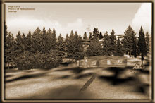
High Lake Lodge
This lodging is situated on in the northwest arm of High Lake on
the Prince of Wales Island. It is near the Klakas Inlet on the southwest
side of the island. There is a dock for mooring your boat or your
floatplane and sufficient room for lodging 4-7 people. Cooking facilities
are available along with plenty of firewood.
TreeTop VFR Plan
From: Ketchikan International
To: High Lake Lodge
1. From PAKT or Totem Bight, head for Vallenar point, at the
northwest end of the Tongass Narrows.
... this will be an approximate heading of 295.
2. At Vallenar Point, set a heading of 190 for 11 miles to Chasina
Point ... the southern point at the entrance of Cholamandeley Sound
... after you make the turn, you will see Vallenar Bay to port on
Gravina Island.
... you are now heading for the Prince of Wales Island, 10 miles
ahead.
... you are flying over the Clarence Straight
... Chasina Point is the port entrance to Cholamandeley Sound.
... Skin Island passes about a mile to starboard.
3. At Chasina Point, set a heading of 199 for 4 miles to Hump
Island.
... Hump Island is in the center of the Cholamandeley Sound about.
Set a heading to fly over it.
4. At Hump Island, set a heading (257) to fly a left-around of
Divide Head. Divide Head is 5 miles away, you will fly to port around
this point.
... You are flying toward the West Arm of Cholamandeley Sound
... as you approach Divide Head, Skinny Cove, a narrow inlet will
be seen off to starboard.
... as Skinny Cove passes to starboard, be ready for a left turn
past Divide Head, which puts you into the South Arm of the Cholamandeley
Sound.
5. You are entering the southern arm of Cholamandeley Sound.
Follow the sound to the very southern end.
... The arm ends in about 5 miles. You will be flying over a low
ridge of 1900 feet, heading for Klakas Inlet. Be sure you have sufficient
altitude.
... Dan's Hideaway is on the port coast near the end of the south
arm you should be able to see it when you near the end of the arm.
6. At the end of the South Arm, you will see a small island.
Fly over this island and set a heading of 175 for the Klakas Inlet.
... Make sure your altitude is a minimum of 1900 feet to go over
the ridge.
... once over the ridge, you will see the Klakas Inlet 1 mile ahead.
... you may drop down to a safe altitude down to enjoy the flight
down the inlet.
... We are going to fly to the entrance of the Klakas Inlet, crossing
over a small peninsula of land (just ahead) and following the shoreline
to starboard, around Shipwreck point, the southernmost point of
land here.
7. At Shipwreck Point, we will continue following the shoreline
to starboard.
... increase altitude to 1900 feet.
... As you come around Shipwreck Point, you will enter Kassa Inlet.
There are two islands ahead, the first one is Kassa Island. (Your
heading will be about (360) or due north.
... at the center of Kassa Island, turn hard to starboard to a heading
of 083 heading for a small cove.
8. At the shoreline of the cove, turn about 90 degrees to starboard
again to 160, this will line you up on High Lake.
... watch the ridge to port which is higher than your 1900 foot
altitude.
9. The lodge will be in a cove of the lake far to the right
in the northwest corner of the lake.
... Be ready to land quickly as you come over the ridge.
... The lake has room to land straight ahead, or, for the more daring
among us, take the curve of the lake to starboard, the lodge is
there at the end of the lake.
Simply reverse this route to return to Vallenar Point.
The direct route back to Vallenar Point is a heading of 011 for
36 miles.
Doug Linn
Charter Manager
Misty Moorings, Inc
contact@mistymoorings.com
|

