 |
|
Route Notes:
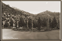
Aiken Creek Camp You will find this little camp situated at a small extension (Aiken Cove) of the north arm of Moria Sound on Prince of Wales Island. This camp has a very tricky approach partly because of the narrow and turning landing zone. The GPS should be set at N55 07.20 W132 12.10. TreeTop VFR Plan From: Ketchikan International 1. Fly a southeast heading down the center of the Tongass Narrows
centering over Pennock Island. 2. Over the center of Pennock Island, turn to starboard on a heading of 146 for 2.5 miles to pass over Gravina Point (the last point of land to the starboard side of the Tongass Narrows). 3. Over Gravina Point, turn a little to starboard to 195 to head over Blank Island 1 mile ahead. 4. Over Blank Island, set a heading of 186 for Bostwick Point,
the second point of land ahead 4 miles away. 5. Over Bostwick Point, set a heading of 169 for 7 miles pointing
you to the Bronaugh Islands, a small group of islands off the Dall
Head, the last point of land of Gravina Island coming up ahead. 6. Over the Bronaugh Islands, get ready for some over-water
flying. We are going to cross the Nichols Passage on our way over
to the Prince of Wales Island. Set a heading of 227 for 10 miles.
(Correct for windage). We are heading for Moria Island, ten miles
ahead in the center of the entrance of Moria Sound. 7. Over Moria Island, turn to starboard to 273. You want to cross over the peninsula of land, Halliday Point, at the entrance of the North Arm (2 miles away). 8. Over Halliday Point fly up the center of the North Arm, a
heading of approximately 288 ... get down to safe landing altitude
(500 feet) and set up landing configuration, your landing zone is
4 miles ahead. Note: this is a short landing zone. To get back to PAKT, simply reverse the route. Doug Linn |
|
If you have any questions or comments, you can contact me at contact@mistymoorings.com |
©2005 mistymoorings.com |
